

7th graders were hard at work on their topographic maps.
Topognosia. Isn’t that a wonderful way to begin a discussion? Toss in a word (that may or may not be real) and try to suss out its meaning much the way a dowser might try to locate water underground. In this case the word happens to be real, and holds the honor of being the first quatra-syllabic word in this blog. Woot. Since the 7th graders just finished their flood unit, a word like topognosia tweaks the curiosity just a tad.
Shame on you. I know your type! For there are more than a few of you who took the opportunity at the end of the previous paragraph to go look up the term for yourself, or to nonchalantly quiz your 7th grader as to its meaning. That’s cheating. Though I will admit to truncating the former paragraph a bit early just to see what fish came up in the net. For the rest of you who plunged bravely on but are still working on their medical terminology, lets break the word down. “Topog” gives no valid hits on Google, but we hit the jackpot with “topo” – 46 million hits, most related to map terrain. As expected. “Nosia” threw me initially, as I inadvertently assumed it was disease-related.
Tossing it out there into the electronic ether brought back a few funny catches. Anosognosic is one of my new favorite terms, as it means one who is unable to recognize that he or she has a disease. There are so many ways to go with this, but in the interest of nurturing a holiday spirit of wholesomaeity (new word just in time for the three day weekend), I will restrain myself, though the effort leaves my fingers quivering. It also produced nosologist, or one who specializes in the classification of diseases. In the end, all of the nosic terms were misleading, for topognosia is not a disease at all. It is the ability to recognize the location of a stimulus on the skin. This is useful for instance in the presence of a horde of hungry mosquitoes when it is painfully necessary to know where and when to slap with abandon.
I must confess to a sense of letdown at this point, for I had hoped that we had at our fingertips a fun new multi-syllabic word to describe the inability of some to look at a topographic map while deep in the woods and unerringly pinpoint their location on it. A moment’s cogitation on the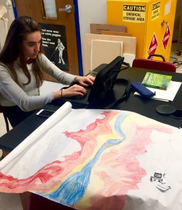 matter reminded me that we already had an effective term for that condition: “lost.”
Within the Flood/Create a National Park unit, there were different roles for each member of the group including Ranger, Mayor, Landscape Architect and Cartographer. Within these roles the 7th graders presented different reports based on their research. We learned about different types of dams, a history of major dam failures, the types of flora and fauna one might expect to encounter along the St. Joe River in Idaho, the setting for our parks, and how the new dam might impact them. The mayors presented brochures inviting tourists to the park, but also had to state their opinion about whether this new park would help or hinder their nearby town, and why. The cartographer worked very hard to create a 2’ x 2’ topographical map of their park replete with a new dam, roads connecting the park to local highways, many hills rising up as high as 3000 feet, and a plethora of park features. It was fun to see the different visions each group had for their park and their new dam, which was intended to stop future floods in the area. This group is anything but lost!